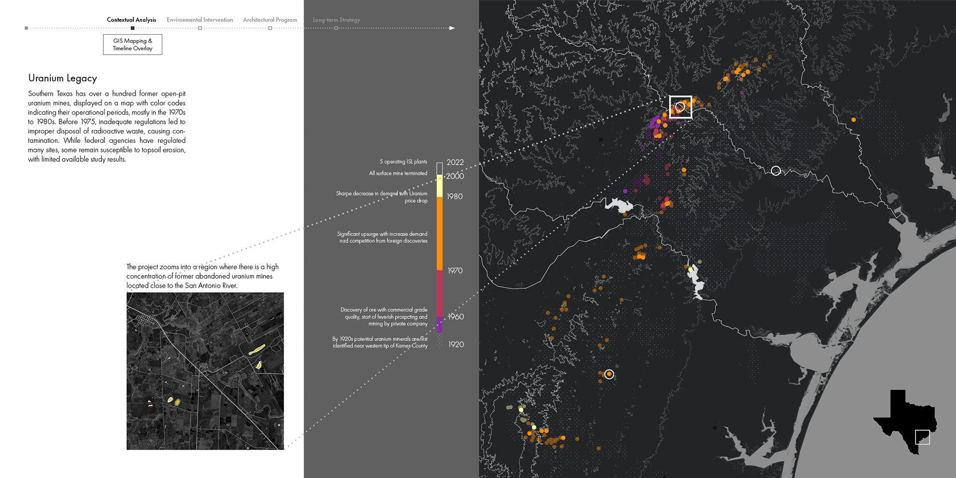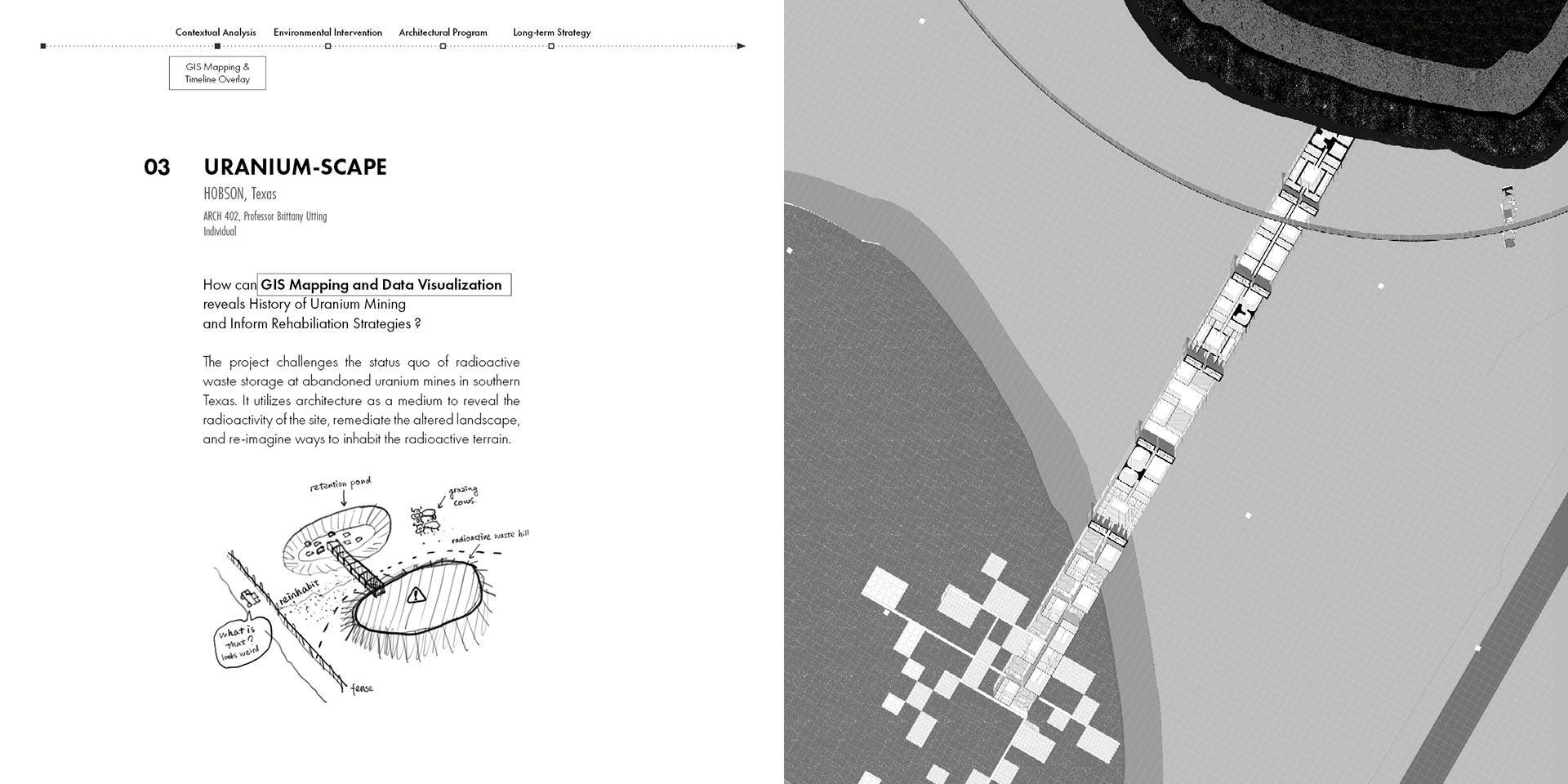
How can GIS mapping and data visualization reveal the history of uranium mining and inform rehabilitation strategies?
Uranium Scape challenges the status quo of radioactive waste storage at abandoned uranium mines in southern Texas. The project uses architecture as a medium to reveal the radioactivity of the site, remediate the altered landscape, and re-imagine ways to inhabit the radioactive terrain.
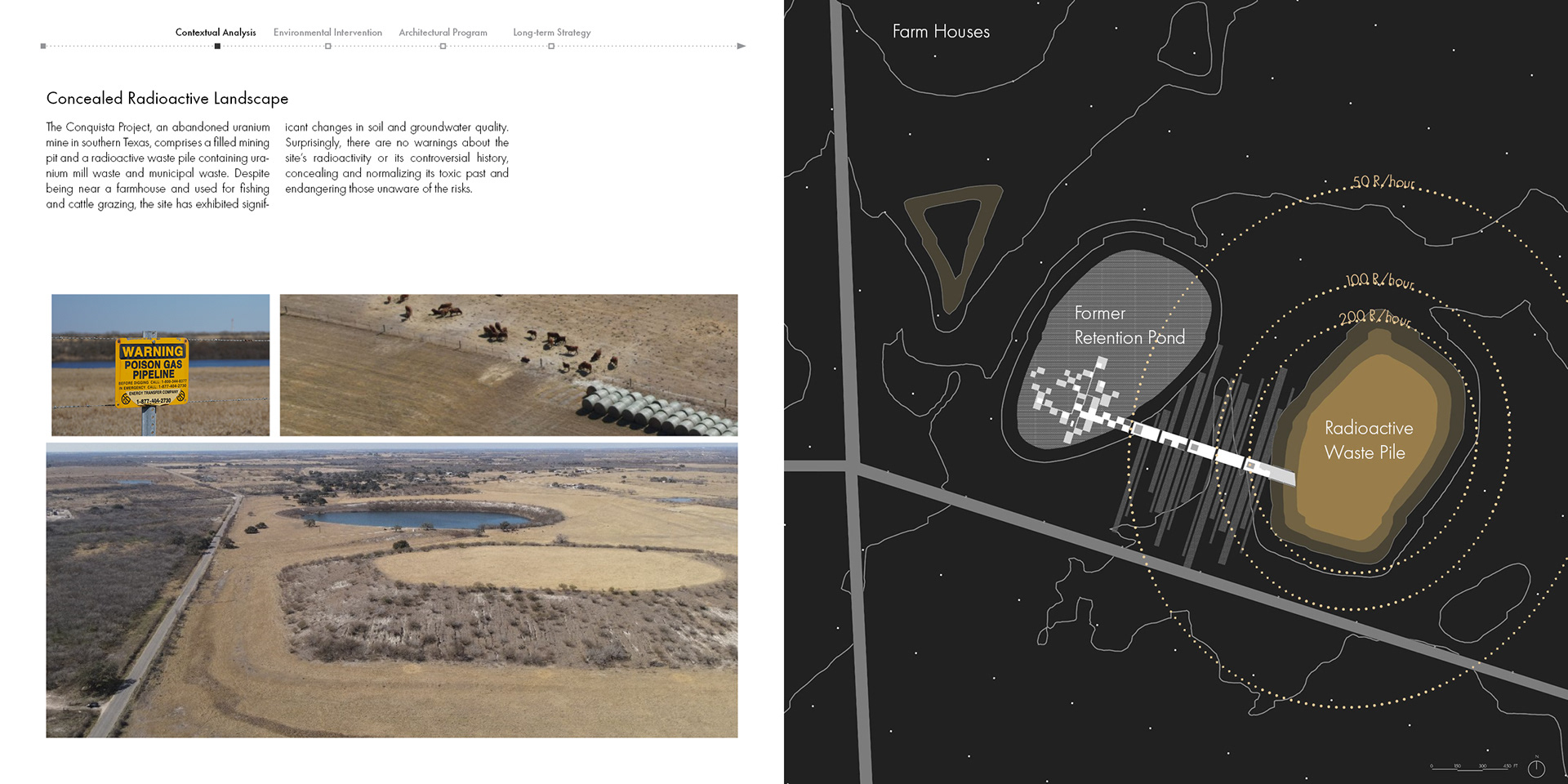
The proposal layers two methods: GIS mapping and historical data visualization to read the site’s mining record, and a sequence of architectural moves that make the contamination legible to a visitor on the ground.